Image
Site Loading
Agriculture
Increase efficiency and yield with aerial technology

With the ability to cover hundreds of acres in a day, the HAWK saves time and cuts down on overhead so farms of all sizes can get more done while increasing their profit margins.

ENJOY MORE ACCURATE RESULTS IN LESS TIME.
Data-link capabilities of up to two miles and over three hours of flight time on a single charge means you can complete missions quickly and conveniently.

STREAMLINE OPERATIONS WITH USER-FRIENDLY GCS
A robust yet easy-to-use ground control system makes it easy for any user to plan flight routes in advance and let the HAWK handle the rest.

Skip the guesswork and make the best decisions for your farm

The HAWK provides you with the bird’s eye view and real-time data you need to make smart decisions for your crops and your profit margins.

Fully Panoramic Views Of Agricultural Fields

Automated Route Planning For Consistent Monitoring

Suitable To Multi-Use Applications

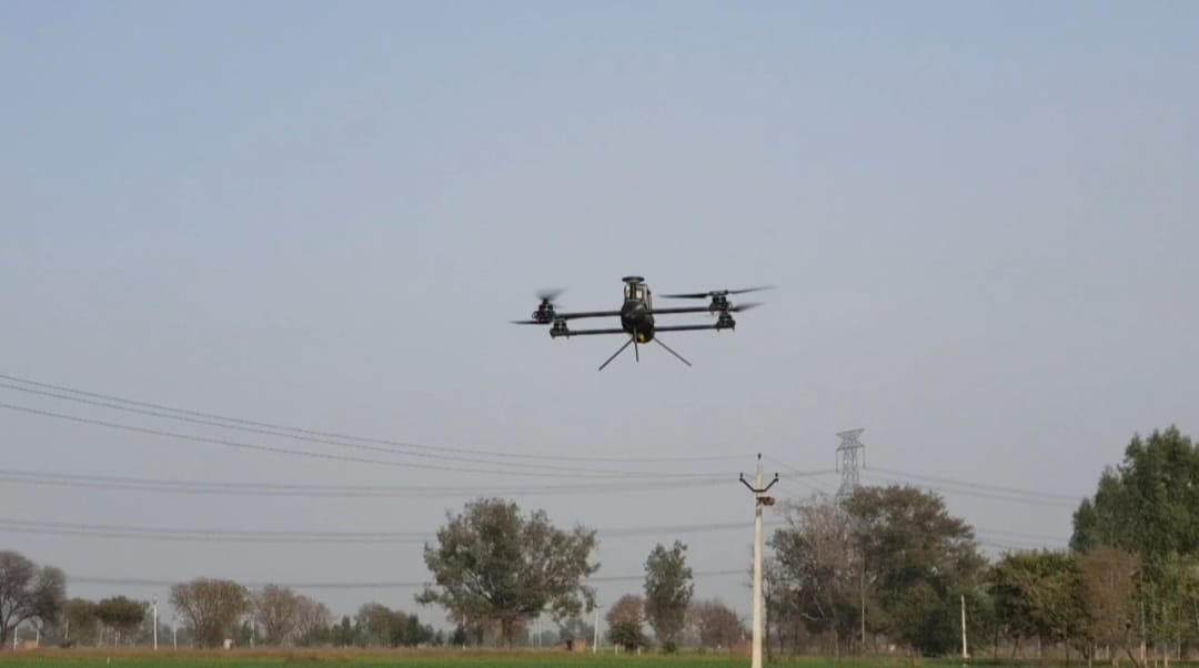
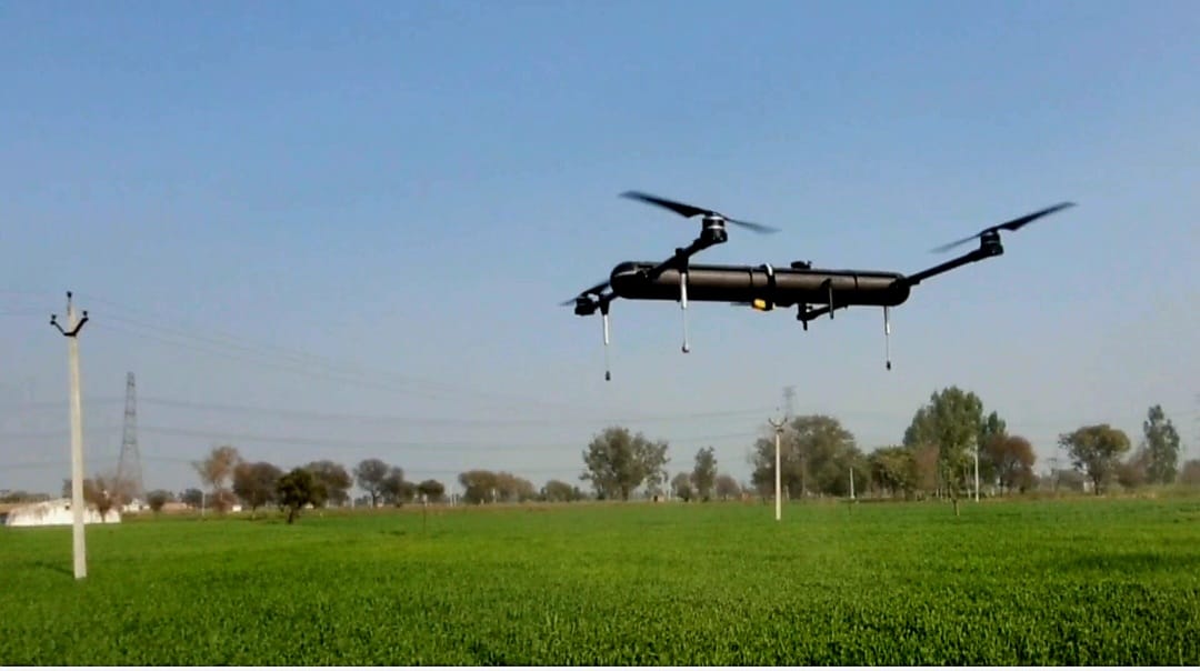
Collect better data in less time

Equipped with cutting-edge technology, the HAWK is the leading aerial solution for farm owners and operators looking to level up their operations and produce high-quality results.
01
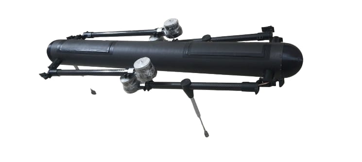
Designed To Fit Your Needs

With a payload lifting capability of over 7 pounds, operators can customize the HAWK with a variety of modular options for precision agriculture, like six-band multispectral cameras and LiDAR sensors.

02
Quick And Easy Assembly

A light, compact build allows for easy transportation of the HAWK, as well as assembly or disassembly in less than three minutes. It’s never been simpler to navigate the skies!

03
Fastest Flight Speed On The Market

Reaching speeds of 70 mph, the HAWK makes short work of agricultural missions — and with over two hours of flight time on a single charge, you’ll have all the data you need in record time.

Image
Image
Image
Image
Image

SAY HELLO
TO REACH US

OUR ADDRESS
B-146, Sagar Estate, Ayodhya By-Pass,
Bhopal, (M.P) INDIA -462041
Your name
Your e-mail
Phone Number
Your message